I'll believe it when I see it.
You are using an out of date browser. It may not display this or other websites correctly.
You should upgrade or use an alternative browser.
You should upgrade or use an alternative browser.
Justin Trudeau hints at boosting Canada’s military spending
- Thread starter Maxman1
- Start date
QV
Army.ca Veteran
- Reaction score
- 3,294
- Points
- 1,010
Not done in isolation, from the article:gotta love the smith government, when the feds step on their toes the lawyers come out, but when her gov steps on the toes of the feds or the citites, its her governments right to do so
Alberta Minister of Public Safety and Emergency Services Mike Ellis said on Thursday there was strong agreement about Alberta's plan to patrol the border with the RCMP's federal police and Canada Border Services Agency (CBSA) when the province met with these groups on Wednesday.
This is doing something to solve a problem... Trudeau's government creates problems. Case in the point; the border.
FJAG
Army.ca Legend
- Reaction score
- 14,151
- Points
- 1,160
We already have helicopters and some surveillance drones; UOR everything else and convert it to a project.I'm more intrigued by how fast he will procure the helicopters and UAVs and get the UAVs certified to operate in proximity to all the civil and military airfields within an hour of the border.
Our problems are in large measure the review and approval processes for projects that aren't priorities for anyone else but the military. Make it a PMO priority and watch the fur fly.15 to 20 years to get approval to operate in the relatively deserted Arctic.
It's a sad state of affairs but it s what it is.
- Reaction score
- 2,260
- Points
- 1,160
that’s Blood Tribe territory.Here is what Alberta is doing
“Sheriff sent a drone up by Chief Mountain, but it never came back from Copperhead Road”
- Reaction score
- 1,968
- Points
- 1,260
Cornwall RCMP officers enter the chat…that’s Blood Tribe territory.
“Sheriff sent a drone up by Chief Mountain, but it never came back from Copperhead Road”
- Reaction score
- 2,260
- Points
- 1,160
Ahhh the water routes …Cornwall RCMP officers enter the chat…
Cue the theme from Akwesasne Vice!
Attachments
- Reaction score
- 8,418
- Points
- 1,160
Not done in isolation, from the article:
Alberta Minister of Public Safety and Emergency Services Mike Ellis said on Thursday there was strong agreement about Alberta's plan to patrol the border with the RCMP's federal police and Canada Border Services Agency (CBSA) when the province met with these groups on Wednesday.
This is doing something to solve a problem... Trudeau's government creates problems. Case in the point; the border.
And the Alberta process started before Trump's Tariff Talk. Smith's government has been working on this patrol since July 2023 - 18 months ago.
Interdiction Patrol Team
51 Uniforms
10 Support Staff (Dispatchers and Analysts)
10 Drones - Cold Weather
4 Drug Patrol Dogs
4 Narcotics Analyzers
29 MCAD per annum
Border length - 298 km
Control Zone - 2 km
Interdiction Area - 596 km2
....
Extrapolation across Canada
Canada US Border
The International Boundary Commission, under International Treaty, maintains the 8,891 km (5,525 miles) boundary shown on 256 official boundary maps. The Commission inspects, maintains and re-establishes over 8,000 monuments and reference points, 1,000 survey control sites and keeps a 6 metre or 20 foot wide clear vista along the land boundary line.
Boundary on Land 5,061 km or 3,145 miles
- Identified by a series of straight lines which intersect at boundary monuments
- 2,172 km (1,350 miles) through forest which requires clearing of a 6 metre (20 feet) vista, on a regular basis
- 5,528 boundary monuments
- 5,700 triangulation stations
- Shortest distance between two boundary monuments: 46 cm (18 inches)
Boundary on Water 3,830 km or 2,380 miles
- Identified by a series of straight lines which intersect at unmarked turning points (except for Turning Points 158 and 159 in Lake Erie and Turning Points 106 and 107 in Lake Ontario, where the boundary follows the parallel of latitude)
- 5,723 Turning Points
- 2,457 Reference Monuments
Length of Boundary by Province/Territory
- New Brunswick - 513 km or 319 miles
- Québec - 813 km or 505 miles
- Ontario - 2,760 km or 1,715 miles
- Manitoba - 497 km or 309 miles
- Saskatchewan - 632 km or 393 miles
- Alberta - 298 km or 185 miles
- British Columbia - 2,168 km or 1,347 miles
- Yukon - 1,210 km or 752 miles
8891 km / 298 km = 29.8 Factor ~ 30
30 x 29 MCAD = 870 MCAD
30 x 51 Uniforms = 1530 Uniforms
30 x 10 Support = 300 Support
30 x 10 Drones = 300 Drones
30 x 4 Dogs = 120 Dogs
30 x 4 Analyers = 120 Narcotics Analyzers.
- Reaction score
- 1,968
- Points
- 1,260
Your going to need to throw in someAnd the Alberta process started before Trump's Tariff Talk. Smith's government has been working on this patrol since July 2023 - 18 months ago.
Interdiction Patrol Team
51 Uniforms
10 Support Staff (Dispatchers and Analysts)
10 Drones - Cold Weather
4 Drug Patrol Dogs
4 Narcotics Analyzers
29 MCAD per annum
Border length - 298 km
Control Zone - 2 km
Interdiction Area - 596 km2
....
Extrapolation across Canada
Canada US Border
8891 km / 298 km = 29.8 Factor ~ 30
30 x 29 MCAD = 870 MCAD
30 x 51 Uniforms = 1530 Uniforms
30 x 10 Support = 300 Support
30 x 10 Drones = 300 Drones
30 x 4 Dogs = 120 Dogs
30 x 4 Analyers = 120 Narcotics Analyzers.
boats for Ontario as much of our border with the US is water based.
RangerRay
Army.ca Veteran
- Reaction score
- 4,001
- Points
- 1,260
We’re looking at the wrong places. The Yanks can guard their own border. What we need to do:
- Bring back the Port Police to stop the pre-cursors from getting into the country
- Get better at going after the money laundering. That is where Canada is really falling down. We’ve become a playground for the global money launderers.
- Bring in “RICO” type legislation to effectively crackdown on these criminal organizations.
- Fix our “intelligence->evidence” problem.
- Invest in the types of police units that can deal in these area, along with Crown prosecutors, judges, court staff and court space so the justice system can be less of a bottleneck than it currently is, and would become more of one if we invested in all of the other items.
RangerRay
Army.ca Veteran
- Reaction score
- 4,001
- Points
- 1,260
Here’s the article I mentioned. From CBC of all places.
- Reaction score
- 8,418
- Points
- 1,160
Your going to need to throw in some
boats for Ontario as much of our border with the US is water based.
From the data posted
Boundary on Water 3,830 km or 2,380 miles
- Identified by a series of straight lines which intersect at unmarked turning points (except for Turning Points 158 and 159 in Lake Erie and Turning Points 106 and 107 in Lake Ontario, where the boundary follows the parallel of latitude)
- 5,723 Turning Points
- 2,457 Reference Monuments
- Reaction score
- 6,241
- Points
- 1,160
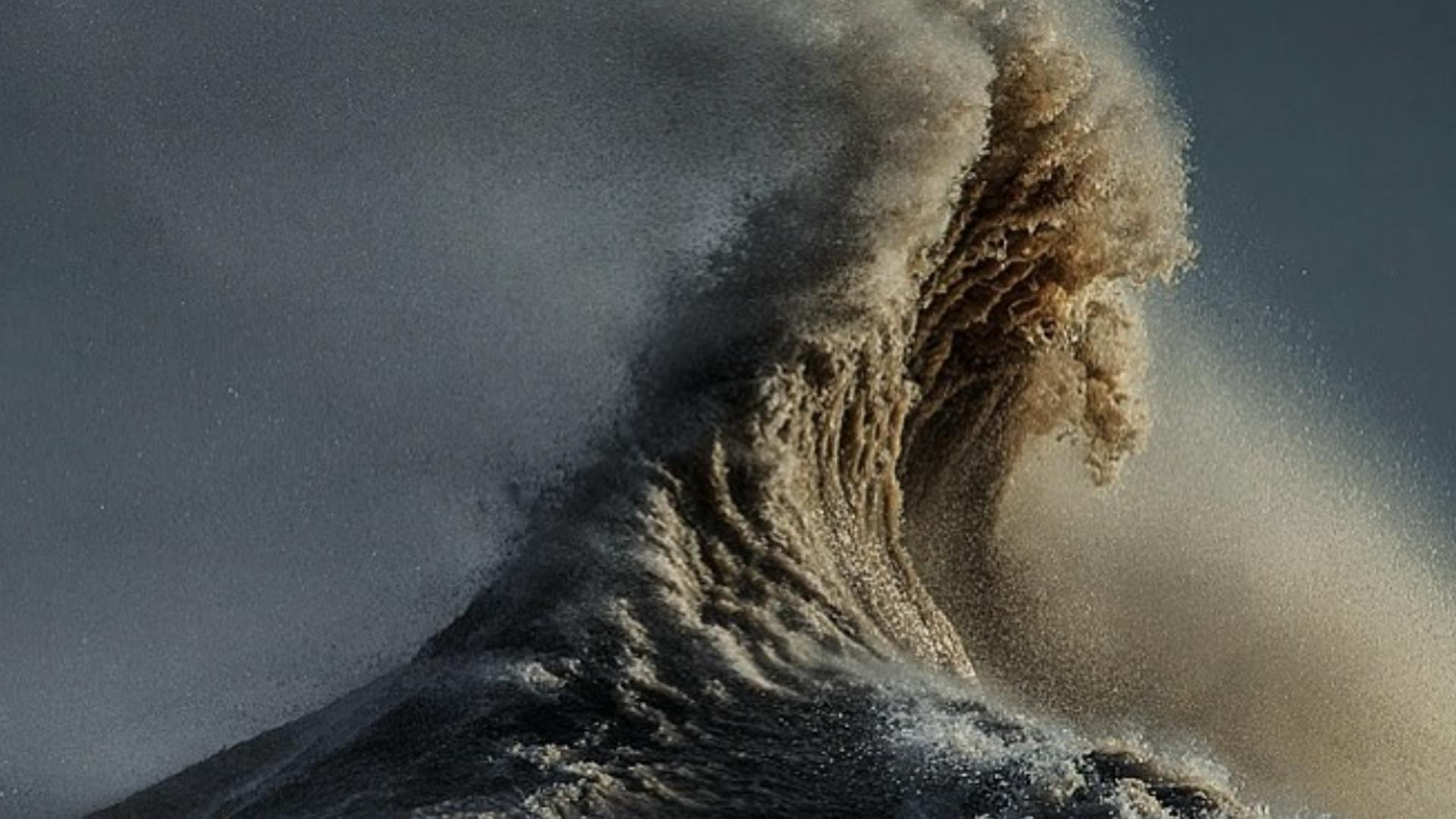
Is that sea ice?Only problem that I see with the boats is that that water can get awfully hard.
View attachment 89728
- Reaction score
- 8,418
- Points
- 1,160
Is that sea ice?

Ice Waves on Lake Huron
This is one of the most amazing things I’ve ever seen. Off Mackinaw City, in a particularly cold winter, the water in Lake Huron below the surface ice supercooled. It expanded to break throug…
FJAG
Army.ca Legend
- Reaction score
- 14,151
- Points
- 1,160
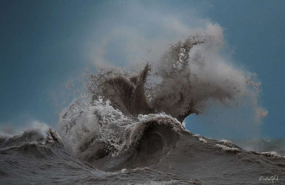
When I retired in 09 we looked for a house on the shores of the St Lawrence, Lakes Ontario, Erie and Huron. I ruled out Huron early on and we settled on waterfront property on Lake Erie. Erie can get rough as well - these are some artsy pictures of Erie.
Ice Waves on Lake Huron
This is one of the most amazing things I’ve ever seen. Off Mackinaw City, in a particularly cold winter, the water in Lake Huron below the surface ice supercooled. It expanded to break throug…travdyn.wordpress.com
/https://tf-cmsv2-photocontest-smithsonianmag-prod-approved.s3.amazonaws.com/882d1f07-f314-4705-8df4-c87aede3403e.jpg)


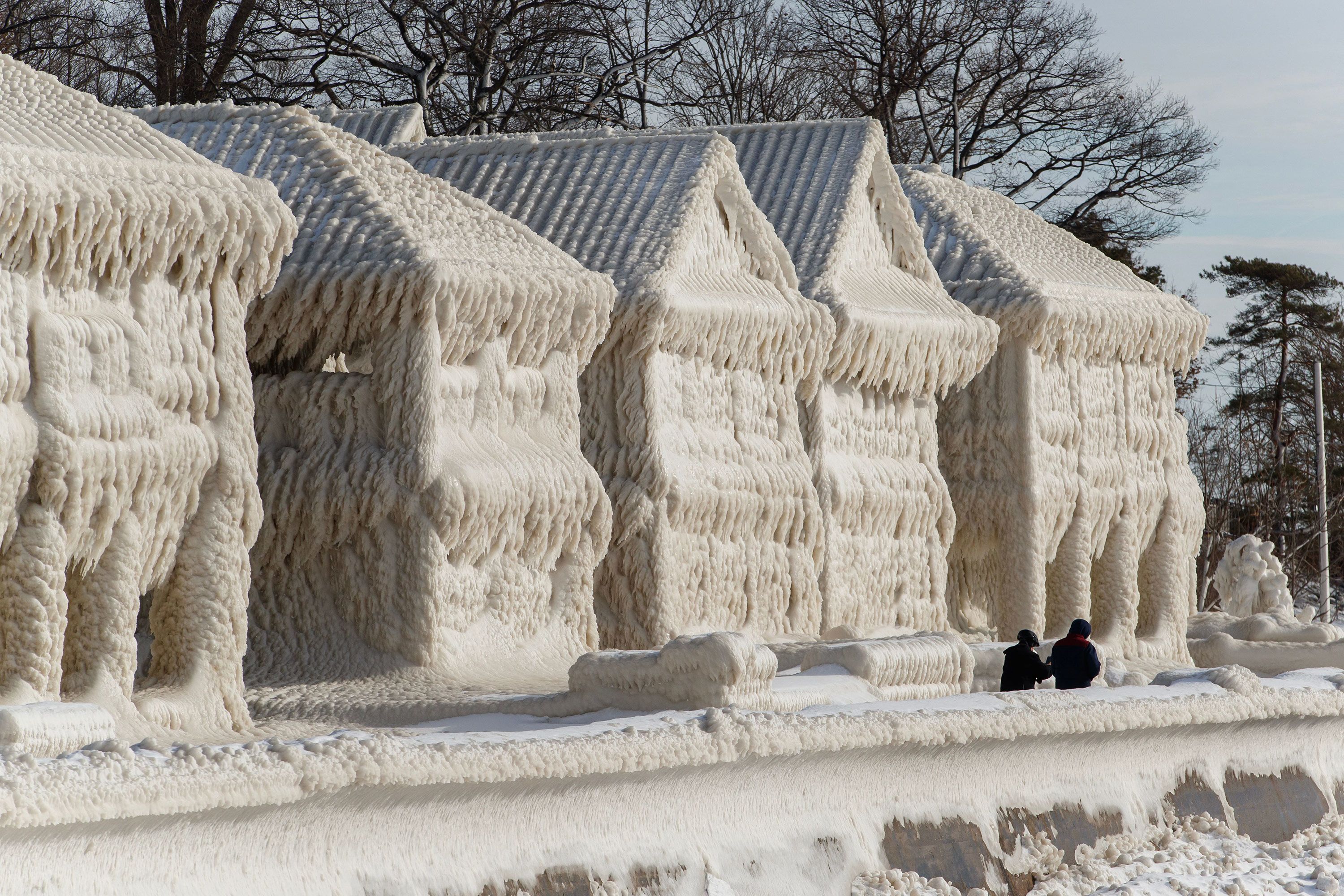
And then there is ice from wind spray and up heave:


Yup. The first few weeks listening to the waves crashing on the shore is quite romantic, the next five years having to wear earplugs at night - not so much. We live inland now.
Halifax Tar
Army.ca Fixture
- Reaction score
- 11,715
- Points
- 1,260
When I retired in 09 we looked for a house on the shores of the St Lawrence, Lakes Ontario, Erie and Huron. I ruled out Huron early on and we settled on waterfront property on Lake Erie. Erie can get rough as well - these are some artsy pictures of Erie.
/https://tf-cmsv2-photocontest-smithsonianmag-prod-approved.s3.amazonaws.com/882d1f07-f314-4705-8df4-c87aede3403e.jpg)


And then there is ice from wind spray and up heave:


Yup. The first few weeks listening to the waves crashing on the shore is quite romantic, the next five years having to wear earplugs at night - not so much. We live inland now.

Im not partial to waterfront. Give me lush green fields and forests of trees any day.
FJAG
Army.ca Legend
- Reaction score
- 14,151
- Points
- 1,160
We always have been fond of staying on the waterfront but living on one for a few weeks on vacation is way different from full-time.Im not partial to waterfront. Give me lush green fields and forests of trees any day.
Mind you the back of our house on Erie was literally 30 feet of deck ending at a sea wall. Our lot had roughly 100' of dry land and 150' of land projecting into the lake. The latter ranged from a narrow band of sandy beach on the other side of the sea wall to 10' under water at the far end.
Halifax Tar
Army.ca Fixture
- Reaction score
- 11,715
- Points
- 1,260
We always have been fond of staying on the waterfront but living on one for a few weeks on vacation is way different from full-time.
Mind you the back of our house on Erie was literally 30 feet of deck ending at a sea wall. Our lot had roughly 100' of dry land and 150' of land projecting into the lake. The latter ranged from a narrow band of sandy beach on the other side of the sea wall to 10' under water at the far end.

I understand. I have too much time on the North Atlantic to hold any romantic or nostalgic notions of big water.
Its grey, cold and angry. And if it wants you it will take you.
When my time is done I will gladly forever put big water behind me. Fields and trees for me.
Similar threads
- Article
- Replies
- 604
- Views
- 234K
- Replies
- 28
- Views
- 13K
- Replies
- 3
- Views
- 4K
- Replies
- 34
- Views
- 13K
- Replies
- 294
- Views
- 57K


