- Reaction score
- 7,122
- Points
- 1,160
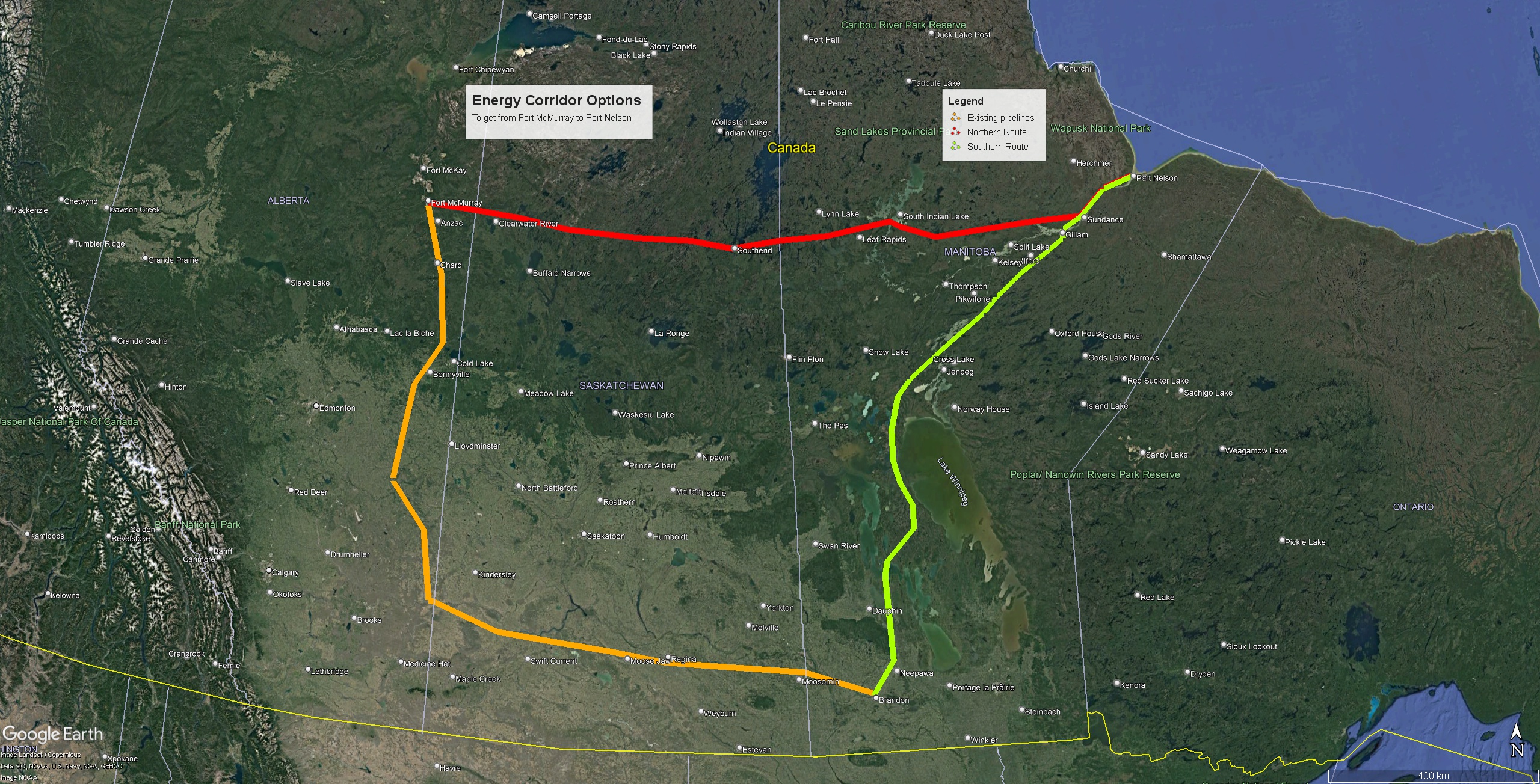
Because it's their idea? A FN-led consortium likely favours a FN-led port.I am struggling to see why they want to use this route over the existing one to Churchill?
From this site:From what I have been told, the ground between say Thompson and Port Nelson is more conducive to construction and the water around the port is deeper
" It was later determined that the port of Churchill, at the mouth of the Churchill River to the north, was better suited to the needs of commercial shipping and the facility at Port Nelson, along with the bridge, was abandoned without ever having been used. "
And from this site:
"The conclusion of the report was that the site is a poor location for a port due to its shallow waters and openness to the north wind, and that the Churchill River was a far superior location offering a natural deep harbor."
"The Nelson River is a less then desirable location for a port as it is wide and open to the north, offering little if any protection for ships. It is also very long and shallow, allowing for only a few hours a day when ships can safely navigate through a narrow channel. Conversely, the Churchill River is a highly desirable location for a port as it has an ideal natural harbor that offers significant protection for ships and has a sufficiently deep channel for most of the route."
Interestingly, it also offers a political angle. Manitoba's border with Ontario had not yet been etched in stone (both provinces once actively claimed the Kenora area - part of me sometimes wish they had won) and there was a concern that Port Nelson might end up in Ontario (if the current border was a straight north-south line, it would have).


")