• Thanks for stopping by. Logging in to a registered account will remove all generic ads. Please reach out with any questions or concerns.

Defending Canadian Arctic Sovereignty

View attachment 65513

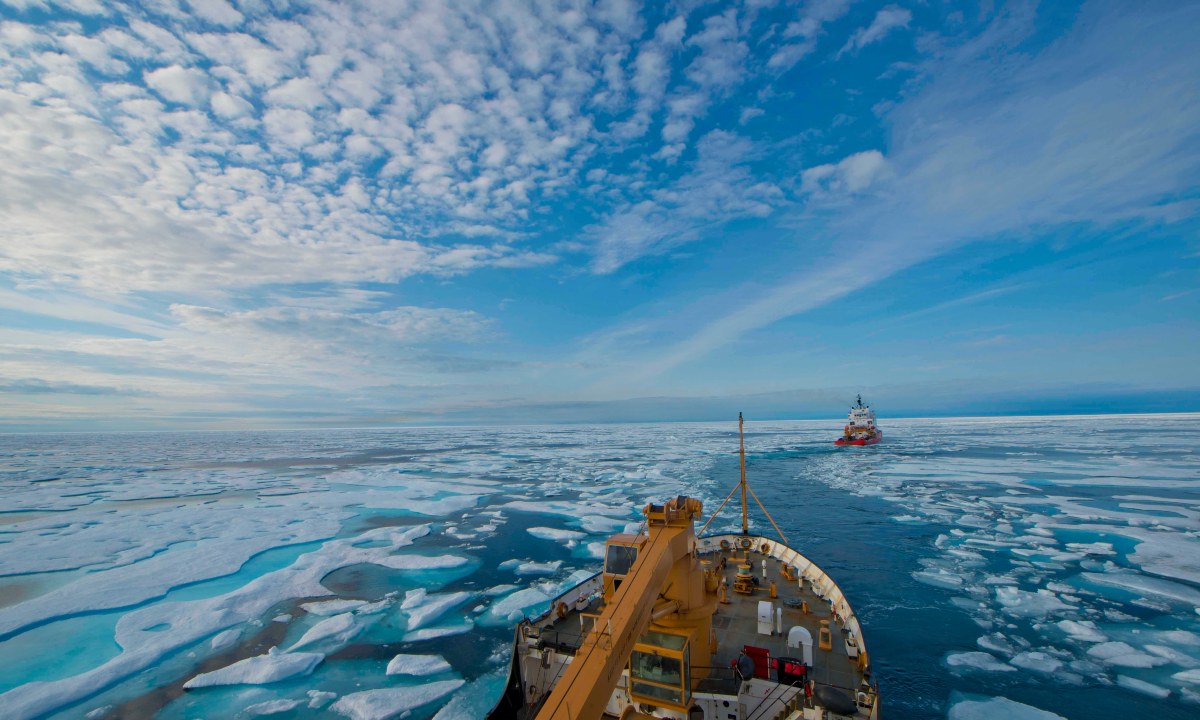
There's your routes, basically two. The northern deep water route and the "traditional" route along the continent. You can change them up by going through different channels west of Resolute but that's really just ice dependant. The northern route has a better chance of multi year ice as you approach the Beaufort Sea. The southern route runs into ice packed up in dams and sheets in the narrow channels near places like Cambridge Bay, even with warmer water because of wind and storms.

The southern route would be suicide for a submarine. The ice regularly scrapes the bottom. The northern route is deeper which might work. However if you are going to the north pole you don't go through the passage. You either go straight shot from the Beaufort Sea or you go straigh shot from Baffin Bay. You don't risk the packed up ice and shoals in the badly sounded Canadian Arctic Archepelago if you can avoid it in a submarine.

I don't consider the Beaufort or Baffin Bay as part of the NWP, perhaps the entrances/exits to it.

And as for bases, Resolute is an Army facility IIRC and just east of it on Baffin Island, along the Eastern entrace to the NWP is Nanisivik, the new refueling station for the RCN and Coast Guard.

I'm guessing it's badly sounded because we don't invest in that kind if thing?
 
I doubt very much that this story is anything more than a myth. I've heard the same story with different permutations told at least twice a year every year I've been in the navy. Some say it was on an exchange in the 90s, or a visiting warship tour, or like said above. Similar to the US carrier task group in an argument with a lighthouse one.

I'm guessing it's badly sounded because we don't invest in that kind if thing?

It's badly sounded for a number of reasons. It's a gigantic amount of area to survey is the first. Something like the entire continental landmass of Europe. It's covered in ice most of the time. It's infrequently traversed. And we've actually been investing in route surveys in our more southern waters and updating those charts as some of those were in need of TLC.

And of course, the limited resources of the navigation survey teams will be focused on where they can do the most good. That's changing though. As the CCG and RCN travel more frequently there will be more info available to update charts. The landmasses are actually fairly well charted, what's below the keel however is usually where the closest land is to a ship.
 
I doubt very much that this story is anything more than a myth. I've heard the same story with different permutations told at least twice a year every year I've been in the navy. Some say it was on an exchange in the 90s, or a visiting warship tour, or like said above. Similar to the US carrier task group in an argument with a lighthouse one.


It's badly sounded for a number of reasons. It's a gigantic amount of area to survey is the first. Something like the entire continental landmass of Europe. It's covered in ice most of the time. It's infrequently traversed. And we've actually been investing in route surveys in our more southern waters and updating those charts as some of those were in need of TLC.

And of course, the limited resources of the navigation survey teams will be focused on where they can do the most good. That's changing though. As the CCG and RCN travel more frequently there will be more info available to update charts. The landmasses are actually fairly well charted, what's below the keel however is usually where the closest land is to a ship.
I have friends who have been up North on RCN ships and have been the first to do lines of soundings in certain areas. They described the experience as surreal to be now included in very small club of explorers and seafarers who have been slowly charting the Arctic since the 1600s.
 
I have friends who have been up North on RCN ships and have been the first to do lines of soundings in certain areas. They described the experience as surreal to be now included in very small club of explorers and seafarers who have been slowly charting the Arctic since the 1600s.

Wouldn't it be fun to establish our own 'Explorer's Club', with the price of admission being contributions to the knowledge base through conducting various mapping/ recce tasks required in the north....

 
I doubt very much that this story is anything more than a myth. I've heard the same story with different permutations told at least twice a year every year I've been in the navy. Some say it was on an exchange in the 90s, or a visiting warship tour, or like said above. Similar to the US carrier task group in an argument with a lighthouse one.


It's badly sounded for a number of reasons. It's a gigantic amount of area to survey is the first. Something like the entire continental landmass of Europe. It's covered in ice most of the time. It's infrequently traversed. And we've actually been investing in route surveys in our more southern waters and updating those charts as some of those were in need of TLC.

And of course, the limited resources of the navigation survey teams will be focused on where they can do the most good. That's changing though. As the CCG and RCN travel more frequently there will be more info available to update charts. The landmasses are actually fairly well charted, what's below the keel however is usually where the closest land is to a ship.
If i recall correctly, I heard it from Bill Noon, who was my Mate on the R Class and was the Captain in charge of the CCG supporting the find of the 2nd Franklin Ship. The Russian Icebreaker was at the pole filming a children special, when the USCG ship broke her blade while on an expedition with the Louis St Laurent, the Russian ship came down to clear ice for the US ship and the Canadian CCG officer went aboard the Russian ship to coordinate with the Russians.
 
If i recall correctly, I heard it from Bill Noon, who was my Mate on the R Class and was the Captain in charge of the CCG supporting the find of the 2nd Franklin Ship. The Russian Icebreaker was at the pole filming a children special, when the USCG ship broke her blade while on an expedition with the Louis St Laurent, the Russian ship came down to clear ice for the US ship and the Canadian CCG officer went aboard the Russian ship to coordinate with the Russians.
I'm not trying to track down the start of the story, nor am I calling anyone a liar. But I really think it's a myth or at the least a tall tail (Sailors never tell those). Like I could read a chart in Cyrillic and understand half of it anyways.

The best myths survive because they have a ring of truth to them. Would it surprise anyone if the Russians had good charts of the Canadian Arctic? No. They stole from everyone, and of course, could buy charts from Nav Canada through an agent if they liked. The idea that Russians are bombing around secretly in the north charting our stuff appeals to us in the defence and security crowd. It's a great confirmation bias story.

I bet, that we could order a chart from the Russians and get one. And do a comparison. It's not like Russian charts are a state secret, they are likely publically available for mariners.
 
I have friends who have been up North on RCN ships and have been the first to do lines of soundings in certain areas. They described the experience as surreal to be now included in very small club of explorers and seafarers who have been slowly charting the Arctic since the 1600s.
One day I hope they take a side scan sonar up there and do a full bottom mapping run along some of the major routes. Instead of a sounding line, you would get routes km wide in a short period of time.

Can a Cyclone dipping sonar be used for bottom mapping? That would be interesting, just to try it out. Big ol' circle of datum.
I don’t know. Off hand, I would think the frequency is wrong (LF) and really, the whole thing is designed to ignore the bottom features In the first place.
 
I didn't read all 37 pages, but............
All this talk about protecting our North is just that.....talk. IMO, Canada hasn't got the capability of protecting any large part of our territory, especially the North. Our only forlorn hope would be in the world courts. We can't flex non existent muscles and we can't stop anyone from walking all over us. We'll, maybe Monaco or Lichtenstein. Seriously, what are we going to do? Blockade the NWP. What kind of threat do some cheap icebreakers pose to a country like China or Russia, if they really wanted to? If they want through, they'll just go. Tell me a tangible threat we can use to stop any incursion into our soveriegn territories.

The one we've used for the past 400 years or so: the weather :)
 
You don't stop foreign vessels from entering our waters with icebreakers, or Coast guard vessels in general for that matter. You stop them by sending officials from the Border services or RCMP to hail them and tell them to leave.


...


And if they don't, we have these beautiful little grey things called CF-18 that can fly up there quickly with little things with white tips under their wings. I can guarantee you that no foreign merchant, scientific or icebreaking vessel can sustain such a show of force, and if they are damaged or sunk, well, they had been warned.

That is the same way we would efface our sovereignty on any of our ocean area,BTW.

I don't believe for one moment that another country would test Canadian resolve after they had been shown what's under the wings by the CF-18. For such government to get sunk or damaged would be considered by most of the world's nation as getting your comeuppance for acting stupidly, and not as a terrible mistake on the part of Canada (I say "most" because there would be exceptions, such as Iran who would probably try to inflate such event as if it was as bad as its own people shooting down an airliner.)

P.S. Colin: I remember the event you are talking about with the Russian ship coming to aid the USCGS Healy and the CGS Louis-St-Laurent, but I also recall that it was in Artcic ocean's open waters near the pole (well fully ice covered), not in the Passage or even in the Canadian Arctic Archipelago, so why shouldn't they have better charts? They have been sailing those waters with their nuclear icebreakers for years, mapping the ocean, as their hiding grounds for their Nuclear Ballistic Missile submarines.
 
Are we warming or cooling now?😉
Warming, which means the weather is actually worse in a lot of places. More heat = more powerful storms.

Tell me a tangible threat we can use to stop any incursion into our sovereign territories.

Tell me a tangible threat that can actually make it to the Canadian arctic when it's covered in ice. And then I'll point you to the airforce. If there isn't ice cover then I'll point you to the navy.

And while you're at it point me to the critical strategic imperative for another country to even attempt an armed challenge of Canadian sovereignty in the arctic. If someone's going to make a crisis of this thing then it better be worth it.
 
One day I hope they take a side scan sonar up there and do a full bottom mapping run along some of the major routes. Instead of a sounding line, you would get routes km wide in a short period of time.

Can a Cyclone dipping sonar be used for bottom mapping? That would be interesting, just to try it out. Big ol' circle of datum.
A lot of private companies do multi-beam survey and can cover a large swath of area in one pass. I was reviewing a potentiel 163km long underwater pipeline to bring NG into Prince Rupert, they had absolutely gorgeous data of the route out to 2km either side. They identified two underwater mountains that did not line up with the Charts and several wrecks. Even though the project did not go ahead, they did turn over some of the data to CHS. CHS does the best they can with the resources they are given, but like everything Canadian we nickel and dime them to death. Same with our topo maps, 20+ years out of date, if you want good mapping data go see McElhanney. Had a meeting with the DM of NRCan at the end of it he said "So anything else we like to talk about?" I gave them a 5 minute lecture on how we stymie development with poor geographic data and asked what they were doing about it, useless gits can't talk about anything without a briefing note in front them. (rant mode off)
For Arctic charts it would be pretty easy for a experienced mariner to make a quick assessment, when you have a chart that is blank between the land masses with the occasional line of sounds. A chart with more lines would stand out. Back in the 90's I got to help survey the area west of Coppermine, including around the Maud. It was neat to be doing chart corrections a couple of years later and see the work you did turned into a insert for the Charts. While steaming in the uncharted areas we would take a sounding every hour and log lat, long, tide and range & bearing if possible, those entries went off to CHS to help fill the blanks.
 
Our only forlorn hope would be in the world courts. We can't flex non existent muscles and we can't stop anyone from walking all over us.
Even if world courts, UN councils, etc all vote against a country like China or Russia, even that is a thin hope at best. We have to HOPE the world courts are in our favour, and we have to HOPE that the subject country actually listens, respects, and responds to the decision accordingly. If China is who we are thinking of - my guess is they won't give a frig, and do their own thing anyway.

Like you guys mentioned, the weather. Let's hope they underestimate the sea states & sheer ugliness of some of that weather, and gives us some time to shake our heads out of the unicorn dust. And with that being said, the Russians won't underestimate it...they've been quite capable of operating there for ages.


If this ever becomes a 'thing' - lets just hope for an odd season, and for hell to freeze over. 🙏
 
Which is why China tries to buy as many votes as it can in the UN, to provide the "Legal Pretence" for whatever action it may take. However they seem to be working hard at undoing that strategy by jerking around the locals in the countries that the Belt and road initiative is going through.
 
Chinese state media have reportedly called the NWP a “golden waterway” for future trade, almost 60 percent of China’s exports are by water, and China considers itself a “Near-Arctic State.” China is keenly interested in getting a foothold in the Arctic region and Canada’s vast Arctic would seem a potential host. Interestingly to Canada and the United States, in 2017 China sent a research icebreaker, the MV Xue Long, through the Northwest Passage, and other Chinese vessels have since visited the Arctic region. While Beijing does not openly admit it, such ships are likely equipped with intelligence-gathering capabilities. Last year, it was announced that a Chinese state-owned mining company, Shandong Gold Mining, had bought a 50 percent share of the Nunavut TMAC Resources Hope Bay gold mining project before the purchase was blocked by the Canadian government on national security grounds. The mine was in Hope Bay on the NWP and only about sixty miles away from a North American Aerospace Defense Command warning station at Cambridge Bay. Recently, China’s People’s Liberation Army was refused participation in winter warfare training at a Canadian Army base at Petawawa, Ontario, which had been planned based on a bilateral defense agreement from 2013 allowing for joint training. To Denmark’s concern, Beijing has expressed an interest in Greenland on the far eastern side of the NWP, including proposals to establish a research station and a satellite ground station, upgrade airports, and expand mining. Like other regions of the world of strategic interest to the Chinese Communist Party, Canada’s Arctic region and the NWP are vulnerable to Chinese activities—both military and commercial—undertaken to further Beijing’s interests by giving it a foothold in the high north.

Canadian sovereignty in the Arctic and its control of the Northwest Passage remain an open-ended question in the face of great power competition, with an increasing threat coming from an aggressive China and a revanchist Russian. The government of Prime Minister Justin Trudeau has largely turned a blind eye to Beijing’s aggressive activities in the whole of Canada. The United States, and the NATO alliance it leads, must remain vigilant as Canada’s good intentions and inaction are not a deterrent to Russian and Chinese intentions and actions in the Canadian far north.

 
Meanwhile US Navy is really interested in European NATO's "high north" off Norway, not in North American Arctic:

Arctic will become ‘contested’ without US presence and partnerships, 2nd Fleet CO warns​


Enhancing presence and cultivating partnerships in the Arctic are vital to ensuring the region does not become a contested space, according to 2nd Fleet Commander Vice Adm. Andrew “Woody” Lewis.

“The Arctic is a cooperative area. But it will only remain a cooperative area if we continue to build those relationships — even with the Russians,” Lewis said at The Navy League’s 2021 Sea-Air-Space Exposition on Monday. “We have to work together because the environment is very, very challenging … and the environment is changing.”

“But if we aren’t present there, and if we aren’t continuing to build those partnerships, it will be a contested space,” said Lewis, who also heads NATO’s Joint Force Command Norfolk.

Failure to maintain presence in the Arctic would “cede the space to the Russians or somebody else,” Lewis said, adding that it could also become a space where conflict arises.

The U.S. Coast Guard, whom Lewis described as the U.S. “experts” in the Arctic, work closely with the Navy’s 2nd, 3rd and 5th Fleets — but he noted partnerships could exist outside of uniformed military or maritime communities.

The U.S. Navy has ramped up its presence in the Arctic in recent years. For example, the aircraft carrier Harry S. Truman and its carrier strike group operated in the Norwegian Sea in 2018 — marking the first time a U.S. aircraft carrier had entered the Arctic Circle since 1991.

More recently, four U.S. Navy ships sailed into the Barents Sea between Russia and Norway in May to complete maritime security operations. The Navy said the operations were the first time a U.S. Navy surface ship had entered the Barents Sea since the mid-1980s
[emphasis added].

In January, the Navy unveiled a “Blue Arctic” strategy for the region. The blueprint, which said the U.S. Navy “must operate more assertively” in the Arctic, cautioned that Russia is reopening old bases and “reinvigorating” regional exercises. Likewise, it predicts that this will continue in the “decades ahead” and that China will step up its naval activity “on, below and above Arctic waters.”..

Weeks after the report’s release, Lewis warned during a Jan. 26 American Enterprise Institute webinar that the Arctic could become the next contested space, noting the Russians were reinvigorating their military capabilities in the Arctic in an attempt to make it a militarily contested zone...

BTW the Vice Commander of US 2nd Fleet is an RCN Rear-Admiral:

Mark
Ottawa
 
Back
Top